Clarence-Rockland
East
Fast Facts
- Population: 26,505 (Statistics Canada, 2021 Census of Population)
- Size: 307.43 km² (Computed from the Statistics Canada Census Subdivision boundary polygon)
- Distance from Parliament Hill: About 38.8 km east (straight-line distance)
Overview
Clarence-Rockland is a separate city on the Ottawa River east of Ottawa, formed in 1998 through the amalgamation of the Town of Rockland with Clarence Township. It is not part of the City of Ottawa. Its town centre, Rockland, is built along Laurier Street and Baseline Road, with a mix of English, French, public and Catholic schools reflecting the area's bilingual community.
Boundaries
Clarence-Rockland is a separate incorporated city with its own official municipal boundary, sourced from Statistics Canada's Census Subdivision boundary file rather than the City of Ottawa's Neighbourhood Study, since it lies entirely outside Ottawa.
Map
History
The geographic Township of Clarence was established in 1798, named after Prince William Henry, Duke of Clarence, with communities settling within it from the early 1840s. The Township Municipality of Clarence was created in July 1853 when it separated from the United Township of Russell, Cambridge and Clarence.
Rockland grew up on the Ottawa River as a lumber town and was incorporated as a separate town in 1908.
Clarence-Rockland was formed on January 1, 1998, through the amalgamation of the Town of Rockland with Clarence Township, creating the single municipality that exists today.
Claim to Fame
Clarence-Rockland's defining feature is its position as a separate, bilingual city on the Ottawa River just east of Ottawa, with its town centre in Rockland along Laurier Street.
Surrounding Neighbourhoods
Clarence-Rockland is a separate municipality bordering the City of Ottawa to the west, with the Ottawa River forming its northern edge and the rural municipality of The Nation to the east.
Architecture
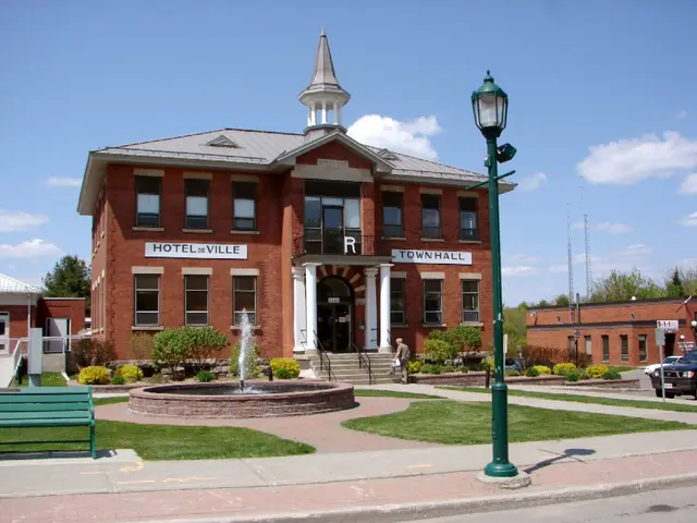
Rockland's town centre along Laurier Street retains early-20th-century commercial buildings, including the heritage-listed town hall, alongside newer retail development; the surrounding township is largely low-density rural and suburban housing.
Restaurants
- Himalaya Indian Cuisine — Indian
Indian restaurant at 655 Laurier Street, serving a breakfast and lunch menu alongside an Indian dinner menu from 4pm.
Visit website - Spartas — Greek
Greek restaurant at 1748 Laurier Street.
- HaloChef Kitchen — African and Caribbean
African and Caribbean restaurant at 2254 Laurier Street, serving charcoal-grilled chicken and goat.
Visit website
Grocery Stores
- Giant Tiger — Discount department and grocery store
Giant Tiger discount department and grocery store at 1657 Laurier Street.
Visit website
Pedestrian and Cycling
Rockland's town centre along Laurier Street is walkable, while the surrounding township is primarily car-dependent; the Ottawa River pathway system extends into parts of the city.
Schools
- Rockland Public School — Upper Canada District School Board
English public elementary school (JK-8) at 999 Giroux Street.
Visit website - Rockland District High School — Upper Canada District School Board
English public secondary school serving Clarence-Rockland.
Visit website
Amenities
 Musée de Clarence-Rockland — Museum
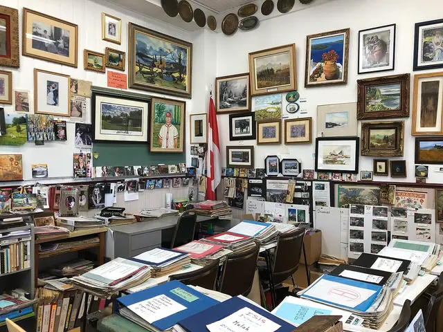
Local history museum documenting Clarence-Rockland's heritage.
Photo: Safyrr, CC BY-SA 4.0, via Wikimedia Commons- Rockland Town Hall — Heritage building
Heritage-listed former town hall on the Ontario Heritage Act Register.
Photo: P199, CC BY-SA 3.0, via Wikimedia Commons
Transit Options
Clarence-Rockland is not part of OC Transpo's service area; residents travel by personal vehicle along Highway 17 and County Road 8, or via the municipality's own local transit and school-bus services.
Nearby on This Site
No listings yet in this area.
Official Information
Last verified: August 27, 2026